Glebe Farm: Work During 2010

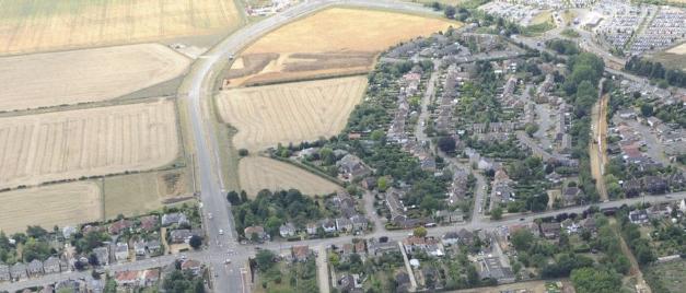
Aerial view of Glebe Farm looking west: Shelford Road in foreground; Addenbrooke’s Road to the left; Glebe Farm centre; Bishop’s Road to the right; guided bus route and Park & Ride site to the upper right. Source: Oxford Archaeology East, July-August 2010.

Aerial view of Glebe Farm looking west. Source: Oxford Archaeology East, July-August 2010.
The Glebe Farm area at the beginning of development work, looking towards Bishop’s Road from Addenbrooke’s Road. Photo: Andrew Roberts, 9 December 2010.
The Glebe Farm area at the beginning of development work, looking towards Bishop’s Road from the Hauxton Road/Addenbrooke’s Road junction. Photo: Andrew Roberts, 9 December 2010.
Driving past Glebe Farm during the opening of Addenbrooke’s Road. Photo: Andrew Roberts, 27 October 2010.
Work on the Glebe Farm junction at the opening of Addenbrooke’s Road. Photo: Andrew Roberts, 27 October 2010.