Trumpington today
Trumpington is primarily a residential area, plus a number of businesses. The original heart of the village – around the High Street, Church Lane and Maris Lane – expanded during the 20th century, with ribbon development along the main roads and housing to the east of the High Street and to the north of Long Road. Since 2010, there have been major housing developments to the west, south and east of the original centre.
The area is popular with people working at the Cambridge Biomedical Campus (Addenbrooke’s Hospital, Royal Papworth Hospital, etc.), Cambridge University and science and biomedical centres such as the Wellcome Sanger Institute.
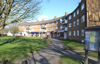
There is a nucleus of shops and pubs in the centre of the village, including a crescent of local shops at Anstey Way. There is a Waitrose supermarket and John Lewis service centre off Hauxton Road. There are also smaller stores on Hobson Square and at the Trumpington Meadows local centre.
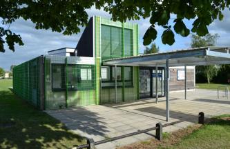
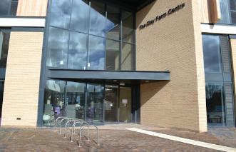
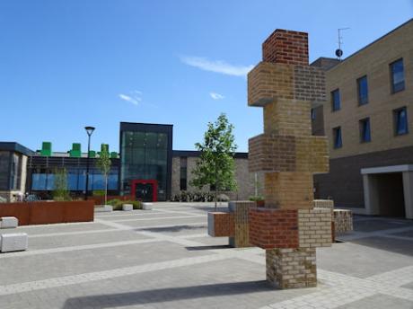
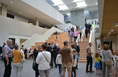
Community facilities include Trumpington Village Hall on the High Street, Trumpington Pavilion, Paget Road, and the Clay Farm Centre alongside Hobson Square, which includes a Library and Medical Centre.
There are three local primary schools: Fawcett Primary School at the end of Alpha Terrace; Trumpington Meadows Primary School on Osprey Drive; and Trumpington Park Primary School on Hobson Avenue. Trumpington Community College is on Lime Avenue. The area also has a number of private schools, between the village and the city centre.
Through traffic was eased by the opening of M11 to the south west of the village in the 1970s, although the growth in commuter traffic through Trumpington into Cambridge has led to significant congestion on the main roads. The Trumpington Park & Ride site was developed at the south west entrance to the village in the 1990s. This is the southern terminus of the Cambridgeshire Guided Busway, which opened in August 2011. Addenbrooke’s Road opened in October 2010.
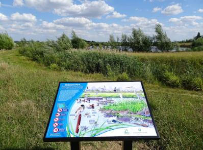
There are two large parks: Trumpington Meadows Country Park with Byron’s Pool and Hobson’s Park. There is a substantial area of farmland to the west of Trumpington Road as far as the River Cam and another green wedge on the east side of the village, either side of Hobson’s Brook and the Vicar’s Brook.
The recent development of Trumpington
The Cambridge and Peterborough Structure Plan, 2003, identified land in Trumpington which could be released from the Green Belt. The shape of development was defined in the Cambridge Local Plan and the Southern Fringe Area Development Framework, published by Cambridge City Council in 2006 In addition, the Cambridge Southern Fringe Area Action Plan (AAP) set out the policy of South Cambridgeshire District Council.
The City Council, District Council and County Council established a Joint Planning Committee to take decisions on the urban extensions to Cambridge.
As an outcome of these planning changes, there have been three major housing developments:
• Clay Farm and the Showground, to the east of the village, in the area between Long Road, Shelford Road and the railway line (Countryside Properties)
• Trumpington Meadows, to the southwest of the village, between Hauxton Road and the river (Grosvenor)
• Glebe Farm, to the south of the village, between Hauxton Road and Shelford Road (Countryside Properties)
The TRA Development Report published in 2004 pressed for the inclusion of community, health and environmental facilities as part of the development. These facilities have been incorporated in the Clay Farm and Trumpington Meadows developments.
Another development with a major impact on Trumpington is the expansion of the Cambridge Biomedical Campus, extending to the west from the original site to the railway.
Trumpington in the past
There were Bronze Age, Iron Age and Roman settlements in the Trumpington area, new evidence for which has been identified during excavations on the Clay Farm and Trumpington Meadows development sites.
By 1085, Trumpington was a thriving community, referred to in the Domesday Book.
The oldest parts of Trumpington are along High Street, Church Lane and Maris Lane. The Church of St Mary and St Michael and its elegant vicarage are complemented by the Old House, Maris House, Anstey Hall and Trumpington Hall and several buildings on High Street. Trumpington Hall has retained a large area of parkland reaching to the river, while Anstey Hall is now a wedding and events venue.
Trumpington remained a predominantly agricultural village until the 20th century, with a number of farms in the village. There were herds of cattle and flocks of sheep as well as a wide range of crops. Most men worked locally on the farms, in the gardens and in small businesses. The leading occupation for women was as a laundress, but there was also domestic service, particularly for the young and single women.
See the Trumpington Local History Group